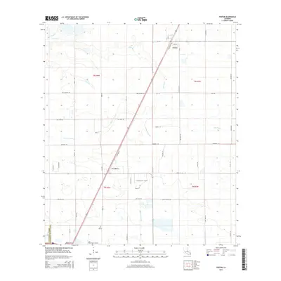
2015 Map of Fenton
USGS Topo · Published 2015About this map
The village of Fenton serves as the primary population center on the border of Calcasieu and Jefferson Davis Parishes in this 2015 study. The landscape is defined by the winding paths of Bayou Arceneaux, Little Bayou, and Bayou Serpent, which cut through a grid of rural roads and agricultural plots. This era of the region's development is characterized by the presence of small private aviation facilities like Lonesome Dove Airfield and Light Plane Flyers Airfield, alongside energy infrastructure reflected in labels such as Miller Oilfield Rd. To the south, the settlement of Woodlawn sits along the rail line, while Pine Hill Cem provides a point of genealogical interest for those tracing family roots in this corner of Louisiana. The transition from large-scale farming to specialized land use is evident in the network of family-named roads like Abie Fontenot Rd and Cormier Village Rd that crisscross the prairie terrain.
Find a feature on this map
46 named features on this map. Tap any name to fly to it.
Don’t see what you’re looking for? This feature index may not catch every label — zoom into the map to look around manually.
Map Details
Editions of this 2015 Fenton Map
This is the sole edition of this map. No revisions or reprints were ever made.
Other maps of this area

1932 · Lake Charles NE
USGS Topo · 1:31,680

1942 · Lake Charles
USGS Topo · 1:62,500

1946 · Lacassine
USGS Topo · 1:31,680

1947 · Kinder
USGS Topo · 1:31,680

1947 · Fenton
USGS Topo · 1:31,680

1947 · Hecker
USGS Topo · 1:31,680

1947 · Pine Island
USGS Topo · 1:31,680

1947 · Welsh
USGS Topo · 1:31,680

1947 · Edna
USGS Topo · 1:31,680

1947 · Thompson Bluff
USGS Topo · 1:31,680