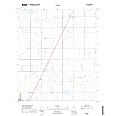
2018 Map of Fenton
USGS Topo · Published 2018About this map
Fenton sits at the northern edge of this southwestern Louisiana landscape, where the prairie begins its transition toward the coastal marshes. This 2018 survey documents a region defined by its complex drainage network, including Bayou Serpent, Little Bayou, and Bayou Arceneaux, which snake across the terrain. The presence of Miller Oilfield Rd and Oilfield Rd indicates the ongoing importance of the petroleum industry to the local economy. Genealogists and local historians will find value in the specific naming of rural thoroughfares such as Abie Fontenot Rd, Carl Hoppe Rd, and Gro Racca Rd, which preserve the names of long-standing local families. The southern portion of the map includes Pine Hill Cem and the Light Plane Flyers Airfield, providing a detailed look at the infrastructure and communal sites that serve this rural parish boundary between Calcasieu and Jefferson Davis.
Find a feature on this map
49 named features on this map. Tap any name to fly to it.
Don’t see what you’re looking for? This feature index may not catch every label — zoom into the map to look around manually.
Map Details
Editions of this 2018 Fenton Map
This is the sole edition of this map. No revisions or reprints were ever made.
Other maps of this area

1932 · Lake Charles NE
USGS Topo · 1:31,680

1942 · Lake Charles
USGS Topo · 1:62,500

1946 · Lacassine
USGS Topo · 1:31,680

1947 · Kinder
USGS Topo · 1:31,680

1947 · Fenton
USGS Topo · 1:31,680

1947 · Hecker
USGS Topo · 1:31,680

1947 · Pine Island
USGS Topo · 1:31,680

1947 · Welsh
USGS Topo · 1:31,680

1947 · Edna
USGS Topo · 1:31,680

1947 · Thompson Bluff
USGS Topo · 1:31,680