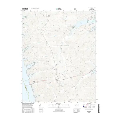
2016 Map of Fenton
USGS Topo · Published 2016About this map
Land Between The Lakes National Recreation Area occupies the heart of this landscape, situated between the expansive waters of Kentucky Lake and Lake Barkley. This 2016 survey documents the complex geography of this peninsula, where numerous inlets like Vickers Bay and Barnett Bay define the western shoreline along the Tennessee River. The inland terrain is marked by a network of drainage systems such as Crooked Cr and Grace Cr, flowing through hollows like Pryor Hollow and Boardinghouse Hollow. Historical footprint remains visible through established burial sites including Pleasant Valley Cem, Jenny Ridge Cem, and Matheny Cem. The small settlements of Fenton and Golden Pond serve as local landmarks along Canton Rd, which provides the primary east-west passage through the recreation area towards the state highway system.
Find a feature on this map
49 named features on this map. Tap any name to fly to it.
Don’t see what you’re looking for? This feature index may not catch every label — zoom into the map to look around manually.
Map Details
Editions of this 2016 Fenton Map
This is the sole edition of this map. No revisions or reprints were ever made.
Other maps of this area

1936 · Mont
USGS Topo · 1:24,000

1936 · Fenton
USGS Topo · 1:24,000

1936 · Hiatt
USGS Topo · 1:24,000

1936 · Birmingham
USGS Topo · 1:24,000

1936 · Golden Pond
USGS Topo · 1:48,000

1936 · Rushing
USGS Topo · 1:24,000

1936 · Hico
USGS Topo · 1:24,000
1938 · Birmingham
USGS Topo · 1:24,000
1940 · Hiatt
USGS Topo · 1:24,000

1942 · Hico
USGS Topo · 1:24,000