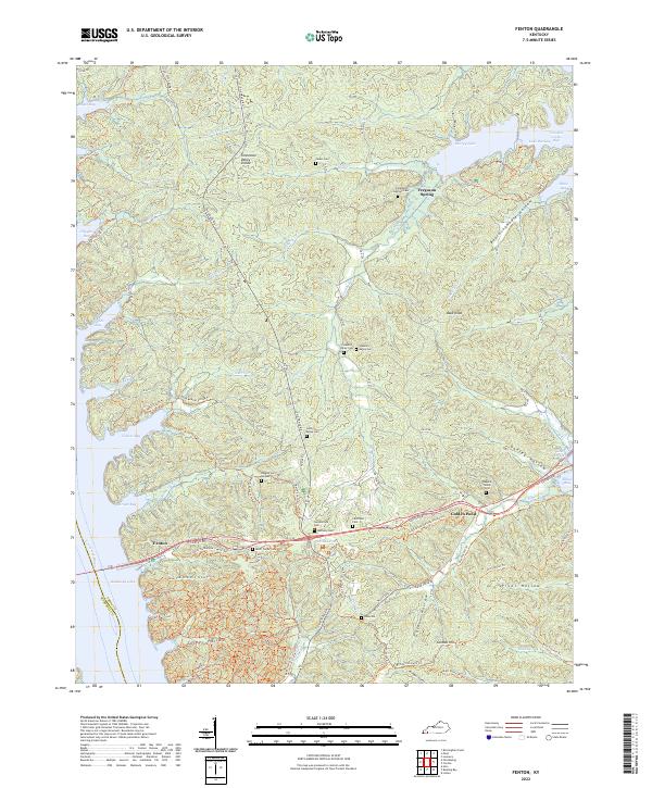
2022 Map of Fenton
USGS Topo · Published 2022About this map
Tennessee Valley Divide anchors this landscape between the major water bodies of Kentucky Lake and Lake Barkley. The terrain is defined by a dense network of hollows and bays, including Boardinghouse Hollow and Vickers Bay, reflecting a topography deeply influenced by the surrounding river systems. Historical settlement patterns are evident through a high concentration of small family and community burial grounds, such as Bogard Family Cem, Litchfield Cem, and Ross Turner Cem, which are scattered throughout the wooded ridges. The presence of Golden Pond and Fenton near the Canton Rd corridor suggests a long-standing transit point across the peninsula. A unique modern layer of the map is the extensive trail system, including the Central Hardwoods Scenic Trl and roads named for western figures like Wyatt Earp Trl, which highlights the area's current role as a managed recreational and wildlife territory.
Find a feature on this map
69 named features on this map. Tap any name to fly to it.
Don’t see what you’re looking for? This feature index may not catch every label — zoom into the map to look around manually.
Map Details
Editions of this 2022 Fenton Map
This is the sole edition of this map. No revisions or reprints were ever made.
Other maps of this area

1936 · Mont
USGS Topo · 1:24,000

1936 · Fenton
USGS Topo · 1:24,000

1936 · Hiatt
USGS Topo · 1:24,000

1936 · Birmingham
USGS Topo · 1:24,000

1936 · Golden Pond
USGS Topo · 1:48,000

1936 · Rushing
USGS Topo · 1:24,000

1936 · Hico
USGS Topo · 1:24,000
1938 · Birmingham
USGS Topo · 1:24,000
1940 · Hiatt
USGS Topo · 1:24,000

1942 · Hico
USGS Topo · 1:24,000