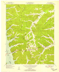
1950 Map of Fenton
USGS Topo · Published 1953About this map
Kentucky Lake dominates the western edge of this landscape, where the Eggner Ferry Bridge connects the shoreline near the settlement of Fenton. This area, famously known as Between the Rivers, is largely occupied by the Kentucky Woodlands Wildlife Refuge, a designation that preserves the rural character of the mid-20th century. Local life is anchored by community landmarks such as Jenny Ridge Church and Loves Eve Church, while numerous family burial grounds like Matheny Cem and Newton Cem are scattered across the wooded ridges.
Find a feature on this map
57 named features on this map. Tap any name to fly to it.
Don’t see what you’re looking for? This feature index may not catch every label — zoom into the map to look around manually.
Map Details
Editions of this 1950 Fenton Map
This is the sole edition of this map. No revisions or reprints were ever made.
Other maps of this area

1936 · Mont
USGS Topo · 1:24,000

1936 · Fenton
USGS Topo · 1:24,000

1936 · Hiatt
USGS Topo · 1:24,000

1936 · Birmingham
USGS Topo · 1:24,000

1936 · Golden Pond
USGS Topo · 1:48,000

1936 · Rushing
USGS Topo · 1:24,000

1936 · Hico
USGS Topo · 1:24,000
1938 · Birmingham
USGS Topo · 1:24,000
1940 · Hiatt
USGS Topo · 1:24,000

1942 · Hico
USGS Topo · 1:24,000