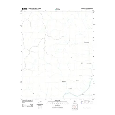
2011 Map of Fern Glen Canyon
USGS Topo · Published 2011About this map
The Colorado River carves through this Mohave County landscape, its course marked by the churning waters of Fern Glen Rapids and the remarkably named Hundred and Sixtyfour Mile Rapids. The terrain is defined by a dense network of steep drainages, including the prominent Fern Glen Canyon, National Canyon, and Tuckup Canyon. In this arid environment, water sources are vital geographic anchors, with named points like Tule Spring, Dome Spring, and Schmutz Spring scattered across the plateau. Natural geological formations provide distinct landmarks, most notably Conglomerate Arch and Alamo Window, while high elevations like The Dome and Big Point offer vantage points over the deep-cut canyon systems. This 2011 survey records the intricate topography where water and rock meet, illustrating how springs and seasonal drainages define the character of this remote canyon country.
Find a feature on this map
19 named features on this map. Tap any name to fly to it.
Don’t see what you’re looking for? This feature index may not catch every label — zoom into the map to look around manually.
Map Details
Editions of this 2011 Fern Glen Canyon Map
This is the sole edition of this map. No revisions or reprints were ever made.
Other maps of this area

1886 · Mt. Trumbull
USGS Topo · 1:250,000

1886 · Kaibab
USGS Topo · 1:250,000

1892 · Mt. Trumbull
USGS Topo · 1:250,000

1953 · Grand Canyon
USGS Topo · 1:250,000

1957 · Grand Canyon
USGS Topo · 1:250,000

1958 · Grand Canyon
USGS Topo · 1:250,000

1960 · Grand Canyon
USGS Topo · 1:250,000

1962 · Tuckup Canyon
USGS Topo · 1:62,500

1962 · National Canyon
USGS Topo · 1:62,500
1967 · Mt. Trumbull NE
USGS Topo · 1:24,000