
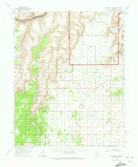
1962 Map of National Canyon
USGS Topo · Published 1964About this map
The Colorado River carves through this remote landscape at the western edge of the Grand Canyon, where the Hualapai Indian Reservation meets the Grand Canyon National Monument. Surveyed in the early 1960s, the map reveals the complex drainage systems of National Canyon and Mohawk Canyon as they descend toward the river. Near the canyon rim, the Tuckup Trail offers one of the few designated routes through this terrain of high points and named overlooks.
Find a feature on this map
25 named features on this map. Tap any name to fly to it.
Don’t see what you’re looking for? This feature index may not catch every label — zoom into the map to look around manually.
Map Details
Editions of this 1962 National Canyon Map
2 editions found
Other maps of this area

1886 · Diamond Creek
USGS Topo · 1:250,000

1886 · Mt. Trumbull
USGS Topo · 1:250,000

1886 · Chino
USGS Topo · 1:250,000

1886 · Kaibab
USGS Topo · 1:250,000

1891 · Chino
USGS Topo · 1:250,000

1892 · Diamond Creek
USGS Topo · 1:250,000

1892 · Mt. Trumbull
USGS Topo · 1:250,000

1948 · Williams
USGS Topo · 1:250,000

1953 · Grand Canyon
USGS Topo · 1:250,000

1954 · Williams
USGS Topo · 1:250,000