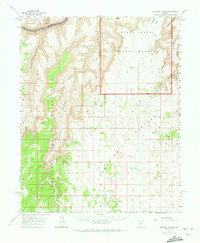
1962 Map of National Canyon
USGS Topo · Published 1973About this map
The Hualapai Indian Reservation dominates the southwestern portion of this landscape, its boundary following the winding course of the Colorado River where it churns through Gateway Rapids. This 1960s era topography documents a transition between the deep incisions of National Canyon and Mohawk Canyon and the high, level expanse of the Coconino Plateau. Evidence of human activity is concentrated at Bishop Camp and several water-management features like Jones Tank and Water Tank, essential for survival on this high desert tableland. In the northeast, the Grand Canyon National Monument protects the dramatic drop-offs of Yunosi Point and Yumtheska Point, while the Tuckup Trail offers a solitary route through the side canyons of the north rim.
Find a feature on this map
35 named features on this map. Tap any name to fly to it.
Don’t see what you’re looking for? This feature index may not catch every label — zoom into the map to look around manually.
Map Details
Editions of this 1962 National Canyon Map
2 editions found

Other maps of this area

1886 · Diamond Creek
USGS Topo · 1:250,000

1886 · Mt. Trumbull
USGS Topo · 1:250,000

1886 · Chino
USGS Topo · 1:250,000

1886 · Kaibab
USGS Topo · 1:250,000

1891 · Chino
USGS Topo · 1:250,000

1892 · Diamond Creek
USGS Topo · 1:250,000

1892 · Mt. Trumbull
USGS Topo · 1:250,000

1948 · Williams
USGS Topo · 1:250,000

1953 · Grand Canyon
USGS Topo · 1:250,000

1954 · Williams
USGS Topo · 1:250,000