
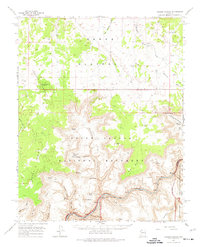
1962 Map of Tuckup Canyon
USGS Topo · Published 1964About this map
Colorado River rapids and the deep dissection of the Kaibab Plateau define this mid-century survey of Arizona's high desert. The map captures a transitional boundary between the Grand Canyon National Monument and the Grand Canyon National Park, revealing a landscape organized by water access and extreme verticality. On the plateau, numerous stock tanks like the June Heaton Tank and School Section Tank illustrate the reliance on collected rainwater for ranching. In the depths of the canyon, the river's power is marked by named hazards such as Havasu Rapids and Fern Glen Rapids, while the south bank marks the boundary of the Hualapai Indian Reservation. Notable landmarks like The Dome and Hancock Knoll stand as significant navigational points in this vast network of drainages and mesas.
Find a feature on this map
59 named features on this map. Tap any name to fly to it.
Don’t see what you’re looking for? This feature index may not catch every label — zoom into the map to look around manually.
Map Details
Editions of this 1962 Tuckup Canyon Map
2 editions found
Other maps of this area

1886 · Mt. Trumbull
USGS Topo · 1:250,000

1886 · Kaibab
USGS Topo · 1:250,000

1892 · Mt. Trumbull
USGS Topo · 1:250,000

1953 · Grand Canyon
USGS Topo · 1:250,000

1954 · Heaton Knolls SE
USGS Topo · 1:24,000

1954 · Heaton Knolls
USGS Topo · 1:62,500

1957 · Grand Canyon
USGS Topo · 1:250,000

1957 · Jumpup Canyon
USGS Topo · 1:62,500

1958 · Grand Canyon
USGS Topo · 1:250,000

1960 · Grand Canyon
USGS Topo · 1:250,000