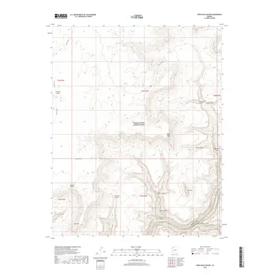
2018 Map of Fern Glen Canyon
USGS Topo · Published 2018About this map
Grand Canyon National Park defines the dramatic vertical landscape of this Mohave and Coconino County border region. The Colorado River snakes through the bottom of the gorge at the southern edge of the sheet, marked by the turbulent Fern Glen Rapids. This map reveals a complex network of side canyons and high plateaus, where water sources like Schmutz Spring and Cottonwood Spring provide rare relief in the arid terrain. The geological transition is punctuated by named landmarks such as The Dome and the natural opening of Alamo Window.
Find a feature on this map
31 named features on this map. Tap any name to fly to it.
Don’t see what you’re looking for? This feature index may not catch every label — zoom into the map to look around manually.
Map Details
Editions of this 2018 Fern Glen Canyon Map
This is the sole edition of this map. No revisions or reprints were ever made.
Other maps of this area

1886 · Mt. Trumbull
USGS Topo · 1:250,000

1886 · Kaibab
USGS Topo · 1:250,000

1892 · Mt. Trumbull
USGS Topo · 1:250,000

1953 · Grand Canyon
USGS Topo · 1:250,000

1957 · Grand Canyon
USGS Topo · 1:250,000

1958 · Grand Canyon
USGS Topo · 1:250,000

1960 · Grand Canyon
USGS Topo · 1:250,000

1962 · Tuckup Canyon
USGS Topo · 1:62,500

1962 · National Canyon
USGS Topo · 1:62,500
1967 · Mt. Trumbull NE
USGS Topo · 1:24,000