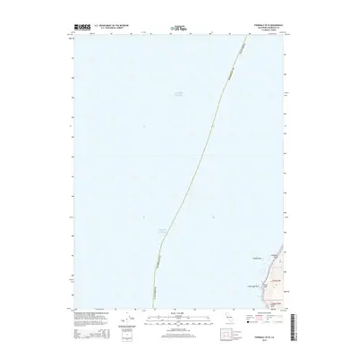
2015 Map of Ferndale OE W
USGS Topo · Published 2015About this map
Pacific Ocean swells meet the westernmost edge of the continent at False Cape, a prominent coastal feature in Humboldt County. This 2015 survey reveals a shoreline defined by sea stacks and rocky outcroppings, including False Cape Rock, Elephant Rock, and Mussel Rock. The terrain inland rises sharply toward the east, marked by steep drainage features such as Flyblow Gulch and the mouth of Oil Cr. While much of the sheet is occupied by open water, the terrestrial portion provides a precise look at the township and range boundaries of t2n r3w and t1n r3w. The map serves as a modern record of this dynamic maritime boundary where the land and sea continuously interact at the edge of northern California.
Find a feature on this map
13 named features on this map. Tap any name to fly to it.
Don’t see what you’re looking for? This feature index may not catch every label — zoom into the map to look around manually.
Map Details
Editions of this 2015 Ferndale OE W Map
This is the sole edition of this map. No revisions or reprints were ever made.
Other maps of this area

1916 · Cape Fortunas
USGS Topo · 1:62,500

1921 · Cape Mendocino
USGS Topo · 1:62,500

1943 · Ferndale
USGS Topo · 1:62,500

1949 · Eureka
USGS Topo · 1:250,000

1950 · Cape Mendocino
USGS Topo · 1:62,500

1951 · Cape Mendocino
USGS Topo · 1:62,500

1951 · Ferndale
USGS Topo · 1:62,500

1958 · Eureka
USGS Topo · 1:250,000
1958 · Eureka
USGS Topo · 1:250,000
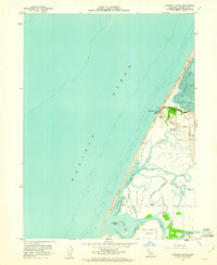
1959 · Cannibal Island
USGS Topo · 1:24,000