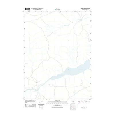
2012 Map of Ferris Lake
USGS Topo · Published 2012About this map
Seminoe Reservoir dominates the lower landscape of this section of Carbon County, where the impounded waters of the N Platte River create a large basin amidst a series of arid drainages. This 2012 record captures the modern hydrology of the area, defined by seasonal watercourses like Dry Ditch and the descriptively named Dirtyman Draw. The namesake Ferris Lake appears as a smaller, isolated body of water to the southeast of the main reservoir. The map illustrates a network of local roads and 4WD tracks that navigate the terrain between these water features, reflecting the remote ranching or recreational character of this Wyoming high-country environment.
Find a feature on this map
5 named features on this map. Tap any name to fly to it.
Don’t see what you’re looking for? This feature index may not catch every label — zoom into the map to look around manually.
Map Details
Editions of this 2012 Ferris Lake Map
This is the sole edition of this map. No revisions or reprints were ever made.
Other maps of this area

1893 · Fort Steele
USGS Topo · 1:125,000

1914 · Walcott
USGS Topo · 1:62,500

1953 · Wild Horse Mountain
USGS Topo · 1:24,000

1953 · Sinclair
USGS Topo · 1:24,000

1953 · Seminoe Dam SW
USGS Topo · 1:24,000

1953 · Seminoe Dam SE
USGS Topo · 1:24,000

1953 · Lone Haystack Mountain
USGS Topo · 1:24,000

1954 · Rawlins
USGS Topo · 1:250,000

1955 · Casper
USGS Topo · 1:250,000

1958 · Rawlins
USGS Topo · 1:250,000