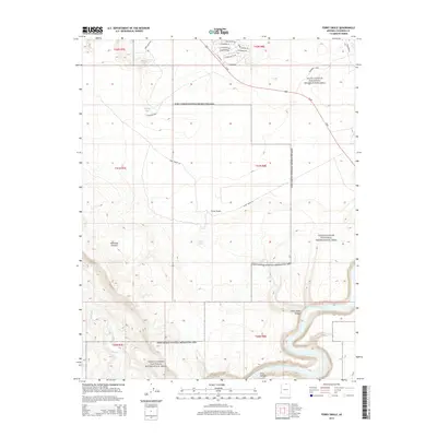
2014 Map of Ferry Swale
USGS Topo · Published 2014About this map
Glen Canyon National Recreation Area dominates this desert landscape north of Page, where the massive sandstone formations and drainage systems of the Colorado River basin are the primary focus. The terrain is defined by complex erosional features like the Thousand Pockets and the steep-walled Ferry Swale Canyon, which leads toward the main channel of the Colorado River. Human infrastructure is concentrated in the northeast, where modern development is visible through streets such as Wahweap Blvd and Stateline Dr near the Utah border. Away from these corridors, the map reveals a remote environment where water management is critical, evidenced by isolated catchments like Bishops Tank and Willow Tank. The junction of the Paria River and the Colorado provides a natural geographic anchor at the bottom of Glen Canyon, illustrating the rugged hydrology that has shaped this part of Coconino County.
Find a feature on this map
30 named features on this map. Tap any name to fly to it.
Don’t see what you’re looking for? This feature index may not catch every label — zoom into the map to look around manually.
Map Details
Editions of this 2014 Ferry Swale Map
This is the sole edition of this map. No revisions or reprints were ever made.
Other maps of this area

1886 · Escalante
USGS Topo · 1:250,000

1886 · Echo Cliffs
USGS Topo · 1:250,000

1891 · Echo Cliffs
USGS Topo · 1:250,000

1922 · Warm Creek
USGS Topo · 1:63,360

1951 · Lees Ferry NE
USGS Topo · 1:24,000

1953 · Nipple Butte
USGS Topo · 1:62,500

1953 · Gunsight Butte
USGS Topo · 1:62,500

1954 · Lees Ferry NW
USGS Topo · 1:24,000

1954 · Lees Ferry SE
USGS Topo · 1:24,000

1954 · Lees Ferry SW
USGS Topo · 1:24,000