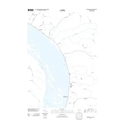
2013 Map of Ferryville
USGS Topo · Published 2013About this map
The Mississippi River and its intricate network of side channels dominate this landscape along the Wisconsin and Iowa border. The river valley is defined by significant landmarks like Lake Winneshiek and Capoli Slough, while the eastern shore features the prominent bluffs of Mount Hope Ridge and Oak Ridge. Inland, the terrain is deeply carved by numerous ravines, including Hobbs Hollow and Kettle Hollow, which lead down toward the water.
Find a feature on this map
51 named features on this map. Tap any name to fly to it.
Don’t see what you’re looking for? This feature index may not catch every label — zoom into the map to look around manually.
Map Details
Editions of this 2013 Ferryville Map
This is the sole edition of this map. No revisions or reprints were ever made.
Other maps of this area

1903 · Waukon
USGS Topo · 1:125,000

1924 · Gays Mills
USGS Topo · 1:62,500

1926 · Gays Mills
USGS Topo · 1:62,500

1926 · Wauzeka
USGS Topo · 1:62,500

1929 · Ferryville
USGS Topo · 1:62,500

1929 · Prairie Du Chien
USGS Topo · 1:62,500

1932 · Ferryville
USGS Topo · 1:62,500

1932 · Prairie Du Chien
USGS Topo · 1:62,500

1958 · La Crosse
USGS Topo · 1:250,000

1961 · La Crosse
USGS Topo · 1:250,000