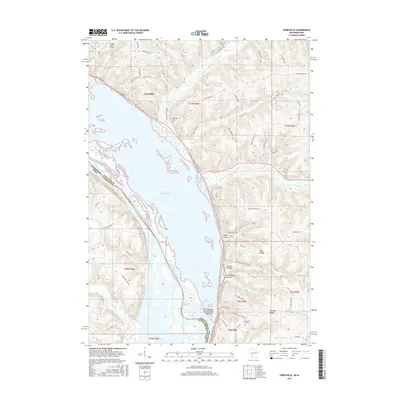
2015 Map of Ferryville
USGS Topo · Published 2015About this map
Ferryville clings to the narrow strip of land between high bluffs and the expansive Mississippi River backwaters, marking a landscape defined by the dramatic relief of the Driftless Area. The river's complexity is on full display here, with the broad Lake Winneshiek and intricate channels like Capoli Slough, Crooked Slough, and Lost Channel weaving through the bottomlands. To the east, the terrain rises sharply into a series of prominent ridges and deep-cut hollows, including Oak Ridge and Mt Hope Ridge, separated by drainages like Sugar Cr and Copper Cr.
Find a feature on this map
75 named features on this map. Tap any name to fly to it.
Don’t see what you’re looking for? This feature index may not catch every label — zoom into the map to look around manually.
Map Details
Editions of this 2015 Ferryville Map
This is the sole edition of this map. No revisions or reprints were ever made.
Other maps of this area

1903 · Waukon
USGS Topo · 1:125,000

1924 · Gays Mills
USGS Topo · 1:62,500

1926 · Gays Mills
USGS Topo · 1:62,500

1926 · Wauzeka
USGS Topo · 1:62,500

1929 · Ferryville
USGS Topo · 1:62,500

1929 · Prairie Du Chien
USGS Topo · 1:62,500

1932 · Ferryville
USGS Topo · 1:62,500

1932 · Prairie Du Chien
USGS Topo · 1:62,500

1958 · La Crosse
USGS Topo · 1:250,000

1961 · La Crosse
USGS Topo · 1:250,000