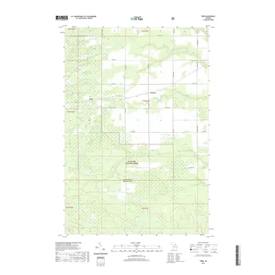
2019 Map of Fibre
USGS Topo · Published 2019About this map
The settlement of Fibre and nearby Dryburg anchor this section of Michigan’s Upper Peninsula, where the landscape is defined by the transition from rural townships into the Hiawatha National Forest. This 2019 survey documents a terrain crisscrossed by numerous waterways, including Pine River, Biscuit Cr, and Trout Brook, which flow through the marshy lowlands of the Chippewa and Mackinac county border. The grid-like road system, featuring family-named routes like Tromblay Rd and Saaranen Rd, reveals the legacy of local land ownership and the area's timber-related history. A specialized Trout Lake - Rudyard (Snow) route highlights the region’s importance for winter transport and recreation, while the southern reaches show the dense drainage network of Chub Cr and Elmhurst Cr within the protected forest boundaries.
Find a feature on this map
34 named features on this map. Tap any name to fly to it.
Don’t see what you’re looking for? This feature index may not catch every label — zoom into the map to look around manually.
Map Details
Editions of this 2019 Fibre Map
This is the sole edition of this map. No revisions or reprints were ever made.
Other maps of this area

1931 · Ozark SE
USGS Topo · 1:31,680

1941 · Strongs
USGS Topo · 1:63,360

1941 · Brimley
USGS Topo · 1:63,360

1951 · Sullivan Creek
USGS Topo · 1:24,000

1951 · Raco
USGS Topo · 1:24,000

1951 · Kinross
USGS Topo · 1:24,000

1951 · Brimley
USGS Topo · 1:62,500

1951 · Strongs
USGS Topo · 1:62,500
1953 · Rudyard
USGS Topo · 1:24,000

1953 · Fibre
USGS Topo · 1:24,000