
1951 Map of Sullivan Creek
USGS Topo · Published 1955About this map
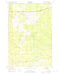
Marquette National Forest dominates this northern Michigan landscape, characterized by a dense network of waterways and early 1950s recreational and military footprints. In the north, Raco Field and an adjacent Rifle Range suggest the strategic importance of the region during the early Cold War era. The Duluth South Shore and Atlantic railroad provides a primary east-west corridor, passing near a Lookout Tower on Demond Hill. The area is deeply defined by its riparian systems, including Sullivan Creek, the Pine River, and several branches of Black Creek. Local human presence is marked by specialized camps and lodges such as Ol Misery Lodge, Camp Quiet, and the Black Creek Hunting Club, alongside public resources like the Sullivan Creek Picnic Ground and a Fish Hatchery.
Find a feature on this map
27 named features on this map. Tap any name to fly to it.
Don’t see what you’re looking for? This feature index may not catch every label — zoom into the map to look around manually.
Map Details
Editions of this 1951 Sullivan Creek Map
3 editions found
Other maps of this area

1941 · Strongs
USGS Topo · 1:63,360

1941 · Brimley
USGS Topo · 1:63,360

1951 · Strongs
USGS Topo · 1:24,000

1951 · McNearney Lake
USGS Topo · 1:24,000

1951 · Pendills Lake
USGS Topo · 1:24,000

1951 · Dollar Settlement
USGS Topo · 1:24,000

1951 · Raco
USGS Topo · 1:24,000

1951 · Brimley
USGS Topo · 1:62,500

1951 · Strongs
USGS Topo · 1:62,500

1953 · Fibre
USGS Topo · 1:24,000
Featured Places
- Trout Lake Township, MI
- Chippewa Township, MI
- Superior Township, MI
- Kinross Township, MI
- Chippewa County, MI