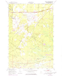
1951 Map of Sullivan Creek
USGS Topo · Published 1978About this map
The Hiawatha National Forest landscape in Chippewa County is characterized by a mix of aviation infrastructure and woodland retreats. Raco Field and its associated Rifle Range dominate the northern plateau, while the Duluth South Shore and Atlantic railway runs along the northern edge, passing through Diamond Hill. This 1951 survey reveals a quiet economy of recreation and conservation, evidenced by the Fish Hatchery and Sullivan Creek Picnic Ground.
Find a feature on this map
28 named features on this map. Tap any name to fly to it.
Don’t see what you’re looking for? This feature index may not catch every label — zoom into the map to look around manually.
Map Details
Editions of this 1951 Sullivan Creek Map
3 editions found
Other maps of this area

1941 · Strongs
USGS Topo · 1:63,360

1941 · Brimley
USGS Topo · 1:63,360

1951 · Strongs
USGS Topo · 1:24,000

1951 · McNearney Lake
USGS Topo · 1:24,000

1951 · Pendills Lake
USGS Topo · 1:24,000

1951 · Dollar Settlement
USGS Topo · 1:24,000

1951 · Sullivan Creek
USGS Topo · 1:24,000

1951 · Raco
USGS Topo · 1:24,000

1951 · Brimley
USGS Topo · 1:62,500

1951 · Strongs
USGS Topo · 1:62,500
Featured Places
- Trout Lake Township, MI
- Chippewa Township, MI
- Superior Township, MI
- Kinross Township, MI
- Chippewa County, MI