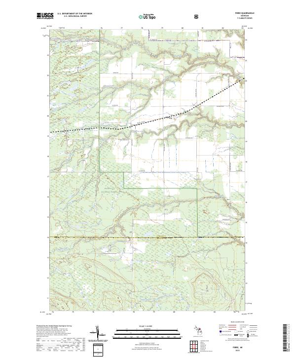
2023 Map of Fibre
USGS Topo · Published 2023About this map
Fibre and Dryburg anchor this rural landscape in the eastern Upper Peninsula, where the grid of county roads meets the dense woodlands of the Hiawatha National Forest. The area is defined by its complex drainage network, with the Pine River winding across the northern sections and several major tributaries, including Biscuit Creek and Bear Creek, cutting through the timberland.
Find a feature on this map
35 named features on this map. Tap any name to fly to it.
Don’t see what you’re looking for? This feature index may not catch every label — zoom into the map to look around manually.
Map Details
Editions of this 2023 Fibre Map
This is the sole edition of this map. No revisions or reprints were ever made.
Other maps of this area

1931 · Ozark SE
USGS Topo · 1:31,680

1941 · Strongs
USGS Topo · 1:63,360

1941 · Brimley
USGS Topo · 1:63,360

1951 · Sullivan Creek
USGS Topo · 1:24,000

1951 · Raco
USGS Topo · 1:24,000

1951 · Kinross
USGS Topo · 1:24,000

1951 · Brimley
USGS Topo · 1:62,500

1951 · Strongs
USGS Topo · 1:62,500
1953 · Rudyard
USGS Topo · 1:24,000

1953 · Fibre
USGS Topo · 1:24,000