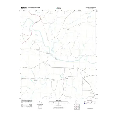
2011 Map of Fickling Mill
USGS Topo · Published 2011About this map
Fickling Mill serves as the focal point for this rural Taylor County landscape, where the waters of Patsiliga Creek and Little Patsiliga Creek converge. The terrain is defined by a complex network of waterways, including the broad Flint River which contains notable features such as Harris Island and Reeves Island. Historic river crossings are documented by the presence of Islands Ford and the uniquely named Suleno juhnene Ford.
Find a feature on this map
47 named features on this map. Tap any name to fly to it.
Don’t see what you’re looking for? This feature index may not catch every label — zoom into the map to look around manually.
Map Details
Editions of this 2011 Fickling Mill Map
This is the sole edition of this map. No revisions or reprints were ever made.
Other maps of this area

1935 · Thomaston
USGS Topo · 1:48,000

1939 · Thomaston
USGS Topo · 1:62,500

1951 · Yatesville
USGS Topo · 1:62,500

1955 · Phenix City
USGS Topo · 1:250,000

1957 · Phenix City
USGS Topo · 1:250,000

1958 · Phenix City
USGS Topo · 1:250,000

1971 · Prattsburg
USGS Topo · 1:24,000
1971 · Lincoln Park
USGS Topo · 1:24,000

1971 · Fickling Mill
USGS Topo · 1:24,000

1971 · Reynolds
USGS Topo · 1:24,000