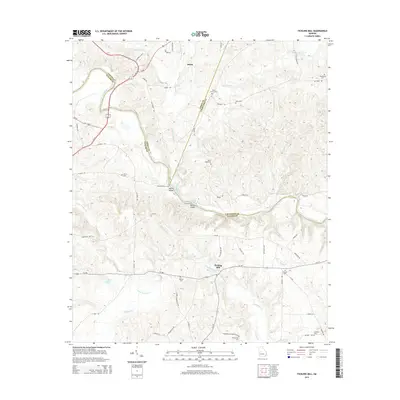
2014 Map of Fickling Mill
USGS Topo · Published 2014About this map
The Flint River carves a deep boundary between Taylor and Crawford counties in this 2014 topographic study of central Georgia. The landscape is defined by the convergence of several major waterways, including Patsiliga Cr and Uleohatchee Cr, which feed into the river alongside historic crossing points like Sulenojuhnene Ford and Islands Ford. Named for the local water-powered industry, Fickling Mill sits at a junction of regional roads, while the small settlement of Salem anchors the northern portion of the quadrangle.
Find a feature on this map
68 named features on this map. Tap any name to fly to it.
Don’t see what you’re looking for? This feature index may not catch every label — zoom into the map to look around manually.
Map Details
Editions of this 2014 Fickling Mill Map
This is the sole edition of this map. No revisions or reprints were ever made.
Other maps of this area

1935 · Thomaston
USGS Topo · 1:48,000

1939 · Thomaston
USGS Topo · 1:62,500

1951 · Yatesville
USGS Topo · 1:62,500

1955 · Phenix City
USGS Topo · 1:250,000

1957 · Phenix City
USGS Topo · 1:250,000

1958 · Phenix City
USGS Topo · 1:250,000

1971 · Prattsburg
USGS Topo · 1:24,000
1971 · Lincoln Park
USGS Topo · 1:24,000

1971 · Fickling Mill
USGS Topo · 1:24,000

1971 · Reynolds
USGS Topo · 1:24,000