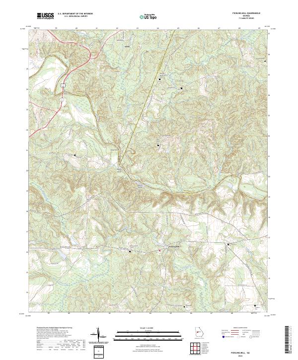
2024 Map of Fickling Mill
USGS Topo · Published 2024About this map
Fickling Mill and the surrounding river bottomlands define this portion of the Georgia landscape where the Flint River creates a natural boundary between Upson, Taylor, and Crawford counties. The terrain is characterized by a dense network of watercourses, including Patsiliga Creek, Auchumpkee Creek, and Mushee Creek, which likely dictated the early settlement patterns and transport routes visible today. Landmarks like Trices Ferry and Grays Ferry point to the historic importance of river crossings in an era before modern bridging was widespread.
Find a feature on this map
69 named features on this map. Tap any name to fly to it.
Don’t see what you’re looking for? This feature index may not catch every label — zoom into the map to look around manually.
Map Details
Editions of this 2024 Fickling Mill Map
This is the sole edition of this map. No revisions or reprints were ever made.
Other maps of this area

1935 · Thomaston
USGS Topo · 1:48,000

1939 · Thomaston
USGS Topo · 1:62,500

1951 · Yatesville
USGS Topo · 1:62,500

1955 · Phenix City
USGS Topo · 1:250,000

1957 · Phenix City
USGS Topo · 1:250,000

1958 · Phenix City
USGS Topo · 1:250,000

1971 · Prattsburg
USGS Topo · 1:24,000
1971 · Lincoln Park
USGS Topo · 1:24,000

1971 · Fickling Mill
USGS Topo · 1:24,000

1971 · Reynolds
USGS Topo · 1:24,000