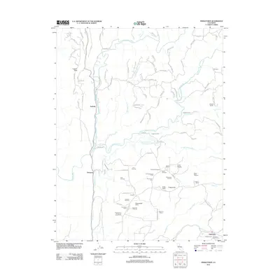
2012 Map of Fiddletown
USGS Topo · Published 2012About this map
Shenandoah Valley defines the southern portion of this landscape, characterized by an extensive network of viticulture and historic settlements. Numerous established estates and facilities such as Story Vineyards, Sobon Estate Vineyards, and D'Agostini Winery are situated throughout the valley, illustrating the region's agricultural identity. To the north, the Cosumnes River and its branches—including the N Fork, Middle Fork, and S Fork—carve through the terrain alongside the engineered Plymouth Ditch. Historic burial grounds such as Shenandoah Cem and the Fiddletown Masonic Cem provide significant reference points for genealogical research. Small communities like Nashville, Enterprise, and Fiddletown anchor the map, connected by a web of local routes including Union Mine Rd and Sand Ridge Rd. The presence of Grizzly Gulch and Prospect Hill further detail the varied topography of this El Dorado County region.
Find a feature on this map
95 named features on this map. Tap any name to fly to it.
Don’t see what you’re looking for? This feature index may not catch every label — zoom into the map to look around manually.
Map Details
Editions of this 2012 Fiddletown Map
This is the sole edition of this map. No revisions or reprints were ever made.
Other maps of this area

1889 · Jackson
USGS Topo · 1:125,000

1891 · Placerville
USGS Topo · 1:125,000

1892 · Jackson
USGS Topo · 1:125,000

1892 · Placerville
USGS Topo · 1:125,000

1893 · Placerville
USGS Topo · 1:125,000

1897 · Jackson
USGS Topo · 1:125,000

1902 · Jackson
USGS Topo · 1:125,000

1941 · Sutter Creek
USGS Topo · 1:62,500

1944 · Sutter Creek
USGS Topo · 1:62,500

1947 · Sacramento
USGS Topo · 1:250,000