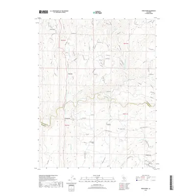
2018 Map of Fiddletown
USGS Topo · Published 2018About this map
Nashville and Enterprise sit at the western edge of this Sierra Nevada foothills region, where the landscape is deeply etched by the various forks of the Cosumnes River. The topography transitions from the prominent Logtown Ridge in the northwest toward the high ground of Prospect Hill and the agricultural pocket of Shenandoah Valley in the south. This survey reveals a complex network of waterways, including the S Fork Cosumnes River and the Middle Fork Cosumnes River, which historically dictated the paths of travel and early industry in these gold-bearing canyons. To the southeast, the historic settlement of Fiddletown is shown alongside the Fiddletown Masonic Cem, preserving the legacy of the area's mid-19th-century boom. The presence of the Shenandoah Pioneer Cem near Pigeon Cr further highlights the deep-rooted local history within these drainage basins.
Find a feature on this map
89 named features on this map. Tap any name to fly to it.
Don’t see what you’re looking for? This feature index may not catch every label — zoom into the map to look around manually.
Map Details
Editions of this 2018 Fiddletown Map
This is the sole edition of this map. No revisions or reprints were ever made.
Other maps of this area

1889 · Jackson
USGS Topo · 1:125,000

1891 · Placerville
USGS Topo · 1:125,000

1892 · Jackson
USGS Topo · 1:125,000

1892 · Placerville
USGS Topo · 1:125,000

1893 · Placerville
USGS Topo · 1:125,000

1897 · Jackson
USGS Topo · 1:125,000

1902 · Jackson
USGS Topo · 1:125,000

1941 · Sutter Creek
USGS Topo · 1:62,500

1944 · Sutter Creek
USGS Topo · 1:62,500

1947 · Sacramento
USGS Topo · 1:250,000