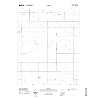
2020 Map of Field SE
USGS Topo · Published 2020About this map
Running Water Draw and Dead Horse Lake punctuate this high plains landscape in eastern New Mexico, where the terrain is defined by a rigorous grid of section lines and county roads. This 2020 survey by the U.S. Geological Survey shows a rural expanse of Curry County characterized by agricultural land management and sparse hydrologic features. The movement of water through this arid environment is traced by intermittent paths such as Creek AD and Creek AC, while the human footprint is established through an extensive network of named thoroughfares including Curry Road AH, Curry Road AF, and Curry Road AE. This map offers a clear view of the Public Land Survey System organization in the region, marking the intersections of several townships including t4n-r32e and t3n r33e.
Find a feature on this map
28 named features on this map. Tap any name to fly to it.
Don’t see what you’re looking for? This feature index may not catch every label — zoom into the map to look around manually.
Map Details
Editions of this 2020 Field SE Map
This is the sole edition of this map. No revisions or reprints were ever made.
Other maps of this area

1954 · Clovis
USGS Topo · 1:250,000

1957 · Portair
USGS Topo · 1:62,500

1957 · Melrose
USGS Topo · 1:62,500

1957 · Hammond Ranch
USGS Topo · 1:62,500

1958 · Clovis
USGS Topo · 1:250,000

1972 · Melrose East
USGS Topo · 1:24,000

1973 · Weber City
USGS Topo · 1:24,000

1973 · Field SE
USGS Topo · 1:24,000

1973 · Melrose West
USGS Topo · 1:24,000

1973 · Field SW
USGS Topo · 1:24,000