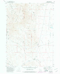
1971 Map of Fields
USGS Topo · Published 1980About this map
Steens Mountain Peaks dominate this high-desert landscape in Harney County, dropping sharply toward the eastern Pueblo Valley (Depression). The map documents a sparsely populated ranching and mining district during the early 1970s, centered on the small outpost of Fields. Evidence of resource extraction is scattered across the slopes, including the Lucky Star Mine near Red Mountain and the Mogul Mine to the southwest.
Find a feature on this map
33 named features on this map. Tap any name to fly to it.
Don’t see what you’re looking for? This feature index may not catch every label — zoom into the map to look around manually.
Map Details
Editions of this 1971 Fields Map
3 editions found
Other maps of this area

1955 · Adel
USGS Topo · 1:250,000

1957 · Adel
USGS Topo · 1:250,000

1958 · Adel
USGS Topo · 1:250,000

1962 · Adel
USGS Topo · 1:250,000

1971 · Fields Basin
USGS Topo · 1:24,000

1971 · Andrews
USGS Topo · 1:24,000

1971 · V Lake
USGS Topo · 1:24,000

1971 · Fields
USGS Topo · 1:24,000

1971 · Borax Lake
USGS Topo · 1:24,000
1971 · Skull Creek Butte
USGS Topo · 1:24,000