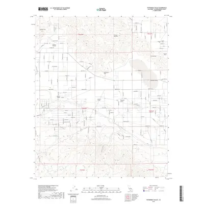
2018 Map of Fifteenmile Valley
USGS Topo · Published 2018About this map
Fifteenmile Valley and its high desert surroundings are defined by stark topographic shifts, where the alluvial flats of the valley floor meet the jagged elevations of the Granite Mountains and the Deadman Hills. This 2018 survey captures the region's complex network of rural desert roads and residential developments, showing how habitation has spread through areas like Fifteenmile Point and towards the prominent landmark of Chimney Rock. The hydrology of the area is centered on the expansive Deadman Dry Lake to the northwest, while the southeastern corner is drained by Silver Creek. Significant geological features, including Arrastre Canyon, Lovelace Canyon, and Grapevine Canyon, reveal the drainage patterns and rugged corridors that carve through the local ranges.
Find a feature on this map
114 named features on this map. Tap any name to fly to it.
Don’t see what you’re looking for? This feature index may not catch every label — zoom into the map to look around manually.
Map Details
Editions of this 2018 Fifteenmile Valley Map
This is the sole edition of this map. No revisions or reprints were ever made.
Other maps of this area

1901 · Southern California Sheet No. 1
USGS Topo · 1:250,000

1902 · Deep Creek
USGS Topo · 1:62,500

1902 · San Gorgonio
USGS Topo · 1:125,000

1904 · Southern California Sheet No. 1
USGS Topo · 1:250,000

1932 · Barstow
USGS Topo · 1:125,000

1934 · Barstow
USGS Topo · 1:125,000

1947 · Lucerne Valley
USGS Topo · 1:62,500

1949 · Lucerne Valley
USGS Topo · 1:62,500

1953 · San Bernardino
USGS Topo · 1:250,000

1955 · Ord Mountains
USGS Topo · 1:62,500