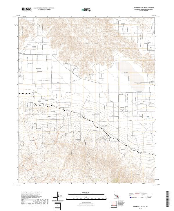
2021 Map of Fifteenmile Valley
USGS Topo · Published 2021About this map
The high desert landscape of Apple Valley and Lucerne Valley is defined by stark contrasts between arid basins and steep mountain ranges. In the northern reaches, the flat expanse of Deadman Dry Lake sits below the Deadman Hills, with Deadman Point marking a sharp transition in the local topography. This region is dominated by the Granite Mountains, which separate the primary valley floor from more rugged terrain to the south. Numerous drainage features like Arrastre Canyon, Lovelace Canyon, and Grapevine Canyon carve through the foothills, indicating the seasonal water flow patterns that have shaped the land. Residential growth is evident in the residential street grids extending from the main settlements towards Sunset Cove and Fifteenmile Point, showing the modern footprint of these Mojave Desert communities. Notable landmarks like Chimney Rock provide fixed points for navigation in a terrain where ephemeral washes like Silver Cr are the only signs of hydrology.
Find a feature on this map
112 named features on this map. Tap any name to fly to it.
Don’t see what you’re looking for? This feature index may not catch every label — zoom into the map to look around manually.
Map Details
Editions of this 2021 Fifteenmile Valley Map
This is the sole edition of this map. No revisions or reprints were ever made.
Other maps of this area

1901 · Southern California Sheet No. 1
USGS Topo · 1:250,000

1902 · Deep Creek
USGS Topo · 1:62,500

1902 · San Gorgonio
USGS Topo · 1:125,000

1904 · Southern California Sheet No. 1
USGS Topo · 1:250,000

1932 · Barstow
USGS Topo · 1:125,000

1934 · Barstow
USGS Topo · 1:125,000

1947 · Lucerne Valley
USGS Topo · 1:62,500

1949 · Lucerne Valley
USGS Topo · 1:62,500

1953 · San Bernardino
USGS Topo · 1:250,000

1955 · Ord Mountains
USGS Topo · 1:62,500