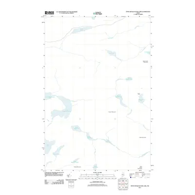
2011 Map of Fifth Musquacook Lake
USGS Topo · Published 2011About this map
Fifth Musquacook Lake and Fourth Musquacook Lake anchor this remote section of the Maine North Woods, where a dense network of glacial ponds and mountain peaks remains largely untouched by major development. The presence of Butlers Camp suggests the enduring heritage of logging and sporting camps that have historically supported the regional economy. The landscape is defined by its dramatic relief, with heights such as Hudson Mountain, Elbow Mountain, and the Peaked Mountain range rising above the basins of Clear Lake and the Lower Elbow Pond chain. Water flows through the drainage systems of Rocky Brook, Big Hudson Brook, and Mule Brook, illustrating the complex hydrology of Piscataquis County. This 2011 survey captures the area’s wilderness character at the start of the 21st century, detailing the small streams like Pleasant Stream and isolated high-altitude waters such as Mountain Pond that characterize this rugged interior territory.
Find a feature on this map
27 named features on this map. Tap any name to fly to it.
Don’t see what you’re looking for? This feature index may not catch every label — zoom into the map to look around manually.
Map Details
Editions of this 2011 Fifth Musquacook Lake Map
This is the sole edition of this map. No revisions or reprints were ever made.
Other maps of this area

1931 · Mooseleuk Lake
USGS Topo · 1:48,000

1932 · Musquacook Lakes
USGS Topo · 1:48,000

1935 · Musquacook Lakes
USGS Topo · 1:62,500

1935 · Mooseleuk Lake
USGS Topo · 1:62,500

1954 · Spider Lake
USGS Topo · 1:62,500

1954 · Millinocket Lake
USGS Topo · 1:62,500

1954 · Presque Isle
USGS Topo · 1:250,000

1958 · Presque Isle
USGS Topo · 1:250,000

1960 · Presque Isle
USGS Topo · 1:250,000

1961 · Spider Lake
USGS Topo · 1:62,500