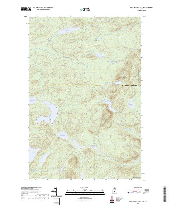
2024 Map of Fifth Musquacook Lake
USGS Topo · Published 2024About this map
Fifth Musquacook Lake and Fourth Musquacook Lake anchor this remote section of the Maine North Woods, where the boundary between Aroostook Co and Piscataquis Co cuts across the timberlands. The landscape is defined by its complex hydrology, featuring isolated water bodies like Mountain Pond, Lost Pond, and Clear Lake. Transportation in this unsettled region is limited to industrial corridors such as Realty Rd and Jack Mtn Rd, reflecting the modern timber management of the territory. High points including Hudson Mtn and Elbow Mtn rise between the drainages of Rocky Brook and Mule Brook, while the southern portion of the sheet is dominated by the Mule Brook Mountains and the Rocky Brook Mountains. This map captures a strictly natural and commercial forest environment, where the absence of established towns highlights the area's role as a working wilderness.
Find a feature on this map
24 named features on this map. Tap any name to fly to it.
Don’t see what you’re looking for? This feature index may not catch every label — zoom into the map to look around manually.
Map Details
Editions of this 2024 Fifth Musquacook Lake Map
This is the sole edition of this map. No revisions or reprints were ever made.
Other maps of this area

1931 · Mooseleuk Lake
USGS Topo · 1:48,000

1932 · Musquacook Lakes
USGS Topo · 1:48,000

1935 · Musquacook Lakes
USGS Topo · 1:62,500

1935 · Mooseleuk Lake
USGS Topo · 1:62,500

1954 · Spider Lake
USGS Topo · 1:62,500

1954 · Millinocket Lake
USGS Topo · 1:62,500

1954 · Presque Isle
USGS Topo · 1:250,000

1958 · Presque Isle
USGS Topo · 1:250,000

1960 · Presque Isle
USGS Topo · 1:250,000

1961 · Spider Lake
USGS Topo · 1:62,500