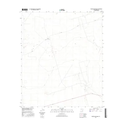
2016 Map of Figure Seven Ranch
USGS Topo · Published 2016About this map
Figure Seven Ranch anchors this high plains landscape in Andrews County, representing the persistent ranching operations that characterize this portion of West Texas. The terrain is marked by subtle topographic variations and intermittent depressions typical of the Llano Estacado. Transportation through this open country is defined by a sparse network of local routes, including SW 900 and SW 9201, which facilitate movement between scattered ranch properties. In the southern portion of the map, State Highway 128 provides a more significant thoroughfare across the arid landscape. The absence of traditional dense settlements underscores the area's specialized use for cattle ranching and resource management in the 21st century.
Find a feature on this map
4 named features on this map. Tap any name to fly to it.
Don’t see what you’re looking for? This feature index may not catch every label — zoom into the map to look around manually.
Map Details
Editions of this 2016 Figure Seven Ranch Map
This is the sole edition of this map. No revisions or reprints were ever made.
Other maps of this area

1954 · Hobbs
USGS Topo · 1:250,000

1958 · Hobbs
USGS Topo · 1:250,000

1969 · Jal NE
USGS Topo · 1:24,000

1969 · Eunice SE
USGS Topo · 1:24,000

1969 · Jal SE
USGS Topo · 1:24,000

1971 · Figure Seven Ranch
USGS Topo · 1:24,000

1971 · Whalen Lake
USGS Topo · 1:24,000

1971 · Bedford Ranch
USGS Topo · 1:24,000

1971 · Frankel City SW
USGS Topo · 1:24,000

1971 · Sand Ranch
USGS Topo · 1:24,000