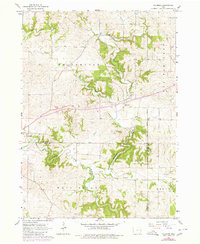
1966 Map of Fillmore
USGS Topo · Published 1980About this map
The North Fork Maquoketa River carves a deep, winding path through the southern half of this landscape, defining the topography near Cascade. The convergence of multiple waterways, including Whitewater Creek, Canyon Creek, and Johns Creek, creates a highly dissected terrain where early agriculture and transport routes had to navigate significant elevation changes. This mid-1960s survey, with later 1970s updates, captures the intersection of three counties—Dubuque, Jones, and Jackson—illustrating how political boundaries follow the section lines across this drainage basin.
Find a feature on this map
19 named features on this map. Tap any name to fly to it.
Don’t see what you’re looking for? This feature index may not catch every label — zoom into the map to look around manually.
Map Details
Editions of this 1966 Fillmore Map
2 editions found
Other maps of this area

1891 · Monticello
USGS Topo · 1:62,500

1891 · Baldwin
USGS Topo · 1:62,500

1900 · Anamosa
USGS Topo · 1:125,000

1901 · Peosta
USGS Topo · 1:125,000

1959 · Dubuque
USGS Topo · 1:250,000

1961 · Dubuque
USGS Topo · 1:250,000

1962 · Dubuque
USGS Topo · 1:250,000
1965 · Dyersville East
USGS Topo · 1:24,000
1966 · Bernard
USGS Topo · 1:24,000
1966 · Fillmore
USGS Topo · 1:24,000