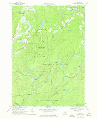
1966 Map of Fine
USGS Topo · Published 1977About this map
The Oswegatchie River flows through the northern reaches of this Adirondack landscape, where the settlement of Fine serves as a primary point of entry. Much of the terrain is defined by the heavy woods and water of the Adirondack State Park and various tracts of State Forest Preserve. Transportation and industry once centered on the Penn Central rail line, which cuts through the southern interior near the old mining site of Jayville and the small settlement at Kalurah.
Find a feature on this map
54 named features on this map. Tap any name to fly to it.
Don’t see what you’re looking for? This feature index may not catch every label — zoom into the map to look around manually.
Map Details
Editions of this 1966 Fine Map
3 editions found
Other maps of this area

1913 · Lake Bonaparte
USGS Topo · 1:62,500

1915 · Gouverneur
USGS Topo · 1:62,500

1915 · Russell
USGS Topo · 1:62,500

1916 · Lake Bonaparte
USGS Topo · 1:62,500

1916 · Oswegatchie
USGS Topo · 1:62,500

1918 · Russell
USGS Topo · 1:62,500

1918 · Oswegatchie
USGS Topo · 1:62,500

1937 · Gouverneur
USGS Topo · 1:62,500

1948 · Ogdensburg
USGS Topo · 1:250,000

1951 · Ogdensburg
USGS Topo · 1:250,000