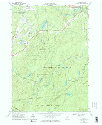
1966 Map of Fine
USGS Topo · Published 1977About this map
The Oswegatchie River snakes across the northern reaches of this Adirondack landscape, anchoring the settlement of Fine and the nearby Camp Portaferry. In the mid-1960s, this region of St. Lawrence County was defined by its vast conservation areas, including the State Forest Preserve and Adirondack State Park. To the south, the Penn Central railroad cuts through the heavy timber and wetlands, passing the remote outpost of Kalurah and the site of an old Mine near Jayville.
Find a feature on this map
55 named features on this map. Tap any name to fly to it.
Don’t see what you’re looking for? This feature index may not catch every label — zoom into the map to look around manually.
Map Details
Editions of this 1966 Fine Map
3 editions found
Other maps of this area

1913 · Lake Bonaparte
USGS Topo · 1:62,500

1915 · Gouverneur
USGS Topo · 1:62,500

1915 · Russell
USGS Topo · 1:62,500

1916 · Lake Bonaparte
USGS Topo · 1:62,500

1916 · Oswegatchie
USGS Topo · 1:62,500

1918 · Russell
USGS Topo · 1:62,500

1918 · Oswegatchie
USGS Topo · 1:62,500

1937 · Gouverneur
USGS Topo · 1:62,500

1948 · Ogdensburg
USGS Topo · 1:250,000

1951 · Ogdensburg
USGS Topo · 1:250,000