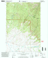
2001 Map of Finn
USGS Topo · Published 2004About this map
Finn sits at the junction of the Avon Valley and the high country of the Helena National Forest, marking a landscape where ranching flats meet the mineral-rich slopes of the Continental Divide. This 2001 revision of the 1968 survey reveals a terrain deeply etched by a history of resource extraction, with numerous unnamed Mines and Prospects scattered across the northern ridges. Significant peaks like Dalton Mountain overlook a complex network of drainages, including California Gulch and Madison Gulch, which historically served as conduits for early mining activity.
Find a feature on this map
29 named features on this map. Tap any name to fly to it.
Don’t see what you’re looking for? This feature index may not catch every label — zoom into the map to look around manually.
Map Details
Editions of this 2001 Finn Map
This is the sole edition of this map. No revisions or reprints were ever made.
Other maps of this area

1889 · Helena
USGS Topo · 1:250,000

1893 · Helena
USGS Topo · 1:250,000

1899 · Helena
USGS Topo · 1:250,000

1903 · Helena
USGS Topo · 1:250,000

1947 · Butte
USGS Topo · 1:250,000

1958 · Butte
USGS Topo · 1:250,000

1958 · Avon
USGS Topo · 1:62,500

1958 · Garrison
USGS Topo · 1:62,500

1960 · Butte
USGS Topo · 1:250,000

1962 · Butte
USGS Topo · 1:250,000