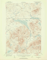
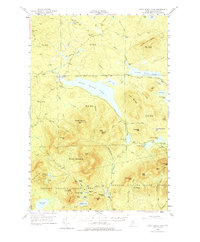
1952 Map of First Roach Pond
USGS Topo · Published 1954About this map
The settlement of Kokadjo serves as the focal point for this 1952 topographic study of the Piscataquis County wilderness, situated where the Roach River exits First Roach Pond. This area is defined by the significant landholdings of the Bowdoin College Grant, reflecting the state's early history of supporting education through vast timberland allotments. The landscape is dominated by notable peaks such as Lily Bay Mtn and Number Four Mtn, the latter featuring a VABM Lookout Tower for fire observation.
Find a feature on this map
99 named features on this map. Tap any name to fly to it.
Don’t see what you’re looking for? This feature index may not catch every label — zoom into the map to look around manually.
Map Details
Editions of this 1952 First Roach Pond Map
6 editions found
Other maps of this area

1920 · Moosehead Lake
USGS Topo · 1:62,500

1922 · Moosehead Lake
USGS Topo · 1:62,500

1930 · Moosehead Lake
USGS Topo · 1:62,500

1940 · Sebec
USGS Topo · 1:48,000

1943 · Sebec
USGS Topo · 1:62,500

1944 · Moosehead Lake
USGS Topo · 1:62,500

1950 · Sebec Lake
USGS Topo · 1:62,500

1951 · Greenville
USGS Topo · 1:62,500

1952 · Jo-Mary Mountain
USGS Topo · 1:62,500

1952 · First Roach Pond
USGS Topo · 1:62,500