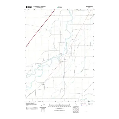
2010 Map of Firth
USGS Topo · Published 2010About this map
The Snake River carves a central path through this Idaho landscape, defining the layout of rural communities and a sophisticated irrigation network. The town of Firth and the neighboring settlement of Basalt serve as the primary population centers, situated near the confluence of several vital water management systems including the Great Western Canal and Snake River Valley Canal. This area reflects a highly engineered agricultural environment where numerous laterals and canals, such as the Aberdeen Springfield Canal and New Lavaside and People Canal, distribute water across the Snake River Plain.
Find a feature on this map
57 named features on this map. Tap any name to fly to it.
Don’t see what you’re looking for? This feature index may not catch every label — zoom into the map to look around manually.
Map Details
Editions of this 2010 Firth Map
This is the sole edition of this map. No revisions or reprints were ever made.
Other maps of this area

1940 · Blackfoot
USGS Topo · 1:62,500

1943 · Blackfoot
USGS Topo · 1:62,500

1948 · Woodville
USGS Topo · 1:24,000

1948 · Idaho Falls South
USGS Topo · 1:24,000

1950 · Woodville
USGS Topo · 1:24,000

1950 · Idaho Falls South
USGS Topo · 1:24,000

1950 · Goshen
USGS Topo · 1:24,000

1951 · Higham Peak
USGS Topo · 1:24,000

1952 · Goshen
USGS Topo · 1:24,000

1955 · Lincoln Creek
USGS Topo · 1:24,000