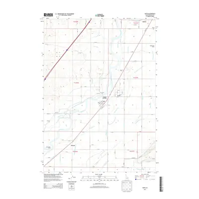
2013 Map of Firth
USGS Topo · Published 2013About this map
The Snake River carves a central path through this Idaho landscape, where a sophisticated network of gravity-fed irrigation sustains the agricultural valley. This 2013 survey documents the intersection of water and transport in Bingham County, highlighting how the Great Western Canal, Blackfoot Canal, and Aberdeen Springfield Canal divert the river's flow to support the surrounding fields. The settlement pattern is concentrated along the river corridor, with the communities of Firth, Basalt, and Goshen Junction serving as focal points for local commerce and residency.
Find a feature on this map
69 named features on this map. Tap any name to fly to it.
Don’t see what you’re looking for? This feature index may not catch every label — zoom into the map to look around manually.
Map Details
Editions of this 2013 Firth Map
This is the sole edition of this map. No revisions or reprints were ever made.
Other maps of this area

1940 · Blackfoot
USGS Topo · 1:62,500

1943 · Blackfoot
USGS Topo · 1:62,500

1948 · Woodville
USGS Topo · 1:24,000

1948 · Idaho Falls South
USGS Topo · 1:24,000

1950 · Woodville
USGS Topo · 1:24,000

1950 · Idaho Falls South
USGS Topo · 1:24,000

1950 · Goshen
USGS Topo · 1:24,000

1951 · Higham Peak
USGS Topo · 1:24,000

1952 · Goshen
USGS Topo · 1:24,000

1955 · Lincoln Creek
USGS Topo · 1:24,000