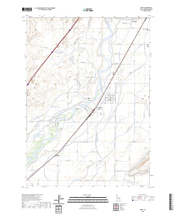
2024 Map of Firth
USGS Topo · Published 2024About this map
Snake River waters dominate this landscape, powering a sophisticated network of irrigation that defines the agricultural character of eastern Idaho. Small settlements like Firth, Basalt, and Shelley are linked by a dense grid of canals and laterals, including the Great Western Canal and the Snake River Valley Canal. The map reveals the intricate water-sharing infrastructure essential to the region, such as the Aberdeen Springfield Canal and the New Lavaside and People Canal.
Find a feature on this map
77 named features on this map. Tap any name to fly to it.
Don’t see what you’re looking for? This feature index may not catch every label — zoom into the map to look around manually.
Map Details
Editions of this 2024 Firth Map
This is the sole edition of this map. No revisions or reprints were ever made.
Other maps of this area

1940 · Blackfoot
USGS Topo · 1:62,500

1943 · Blackfoot
USGS Topo · 1:62,500

1948 · Woodville
USGS Topo · 1:24,000

1948 · Idaho Falls South
USGS Topo · 1:24,000

1950 · Woodville
USGS Topo · 1:24,000

1950 · Idaho Falls South
USGS Topo · 1:24,000

1950 · Goshen
USGS Topo · 1:24,000

1951 · Higham Peak
USGS Topo · 1:24,000

1952 · Goshen
USGS Topo · 1:24,000

1955 · Lincoln Creek
USGS Topo · 1:24,000