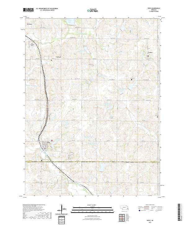
1965 Map of Firth
USGS Topo · Published 1966About this map
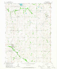
Firth sits at the southwestern edge of this landscape, positioned where the Chicago Burlington and Quincy railroad tracks cross the Middle Branch Big Nemaha River. The area is defined by the intersection of rural townships including Saltillo, Nemaha, and Panama, characterized by a grid of farm roads and small agricultural settlements. To the north, the Wagon Train Lake State Recreation Area surrounds Wagon Train Lake, providing a contrast to the surrounding fields. The rail infrastructure was vital to the region's economy in the mid-1960s, with the Missouri Pacific line cutting through the northern reaches near Holland and Panama. Local history is preserved through several rural institutions, including the Pella Reformed Ch and a collection of family and community burial grounds such as Holland Cem and Pella Cem.
Find a feature on this map
26 named features on this map. Tap any name to fly to it.
Don’t see what you’re looking for? This feature index may not catch every label — zoom into the map to look around manually.
Map Details
Editions of this 1965 Firth Map
This is the sole edition of this map. No revisions or reprints were ever made.
Historical Maps of Hickman Through Time
5 maps found