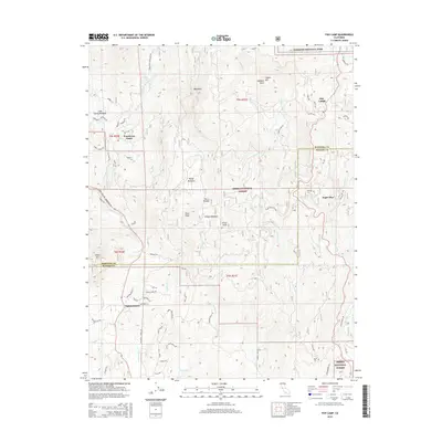
2015 Map of Fish Camp
USGS Topo · Published 2015About this map
Sierra National Forest dominates the terrain of this high-elevation landscape where the boundaries of Mariposa and Madera counties meet. The area is defined by massive granite features and peaks, including the prominent Bald Rock, Pilot Peak, and Wamelo Rock. Small settlements are scattered along the winding forest roads, from the mountain community of Fish Camp near the Yosemite National Park border to Sugar Pine and Nipinnawasee further south. The hydrography of the region is characterized by steep drainages, with the E Fork Chowchilla River and Lewis Fork carving through the slopes. Notable landmarks like Red Rock Falls and Sunny Meadows provide specific reference points for those tracing the historical development of these timber and recreation lands. The network of forest roads, such as Chowchilla Mountain Rd and Boot Jack Rd - Ahwahnee Rd, reflects the long-standing access routes into the southern Sierra Nevada.
Find a feature on this map
69 named features on this map. Tap any name to fly to it.
Don’t see what you’re looking for? This feature index may not catch every label — zoom into the map to look around manually.
Map Details
Editions of this 2015 Fish Camp Map
This is the sole edition of this map. No revisions or reprints were ever made.
Other maps of this area

1897 · Yosemite
USGS Topo · 1:125,000

1900 · Yosemite
USGS Topo · 1:125,000

1903 · Yosemite
USGS Topo · 1:125,000

1909 · Yosemite
USGS Topo · 1:125,000

1912 · Mariposa
USGS Topo · 1:125,000

1947 · Mariposa
USGS Topo · 1:250,000

1947 · El Portal
USGS Topo · 1:62,500

1947 · Mariposa
USGS Topo · 1:62,500

1947 · Buckingham Mtn
USGS Topo · 1:24,000
1947 · Stumpfield Mtn.
USGS Topo · 1:24,000