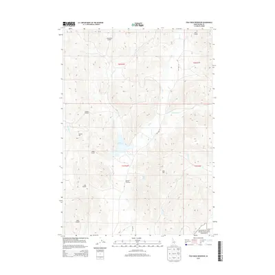
2013 Map of Fish Creek Reservoir
USGS Topo · Published 2013About this map
Fish Creek Reservoir serves as the central focal point of this high-elevation landscape in Blaine County. Fed by the W Fork Fish Cr and draining into Fish Cr, the reservoir is a critical water source in a region defined by complex drainage systems like Crooks Cr and Huff Cr. The southern edge of the sheet touches the volcanic landscape of the Craters of the Moon National Preserve, indicating the transition into Idaho's expansive basalt fields.
Find a feature on this map
25 named features on this map. Tap any name to fly to it.
Don’t see what you’re looking for? This feature index may not catch every label — zoom into the map to look around manually.
Map Details
Editions of this 2013 Fish Creek Reservoir Map
This is the sole edition of this map. No revisions or reprints were ever made.
Other maps of this area

1935 · MacKay
USGS Topo · 1:96,000

1955 · Idaho Falls
USGS Topo · 1:250,000

1958 · Idaho Falls
USGS Topo · 1:250,000

1960 · Muldoon Canyon
USGS Topo · 1:62,500

1960 · Grouse
USGS Topo · 1:62,500

1972 · Little Park
USGS Topo · 1:24,000

1972 · Blizzard Mtn South
USGS Topo · 1:24,000

1978 · Craters Of The Moon
USGS Topo · 1:100,000
1979 · Paddelford Flat
USGS Topo · 1:24,000
1979 · Lake Hills
USGS Topo · 1:24,000