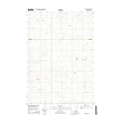
2015 Map of Fish Draw
USGS Topo · Published 2015About this map
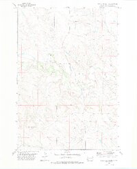
The N Fork Moreau River meanders across this High Plains landscape at the boundary of Harding and Butte counties. This area is characterized by a complex network of ephemeral drainages, including Fish Draw, North Fork Fish Draw, and Sweetwater Draw. These geological features dominate the eastern half of the quadrangle, while the western reaches are defined by Palmer Draw and various creek systems such as Spring Cr and Cottonwood Cr. Human presence is delineated primarily by section-line roads and rural corridors. Marty Rd and Cottonwood Township Rd provide the primary access through this rangeland, following the rectilinear patterns of the Public Land Survey System. The map captures a moment in the mid-2010s where the terrain remains largely defined by its natural hydrology and township boundaries, with Zeona Rd traversing the southern edge of the survey area.
Find a feature on this map
17 named features on this map. Tap any name to fly to it.
Don’t see what you’re looking for? This feature index may not catch every label — zoom into the map to look around manually.
Map Details
Editions of this 2015 Fish Draw Map
This is the sole edition of this map. No revisions or reprints were ever made.
Other maps of this area

1935 · Hoover
USGS Topo · 1:125,000

1954 · Lemmon
USGS Topo · 1:250,000

1957 · Lemmon
USGS Topo · 1:250,000

1968 · Irish Butte
USGS Topo · 1:24,000

1968 · Sheep Mountain
USGS Topo · 1:24,000
1973 · Deers Ears Butte North
USGS Topo · 1:24,000
1978 · Porter Creek
USGS Topo · 1:24,000
1978 · Fish Draw
USGS Topo · 1:24,000
1978 · Tomato Can Buttes
USGS Topo · 1:24,000

1980 · Redig
USGS Topo · 1:100,000