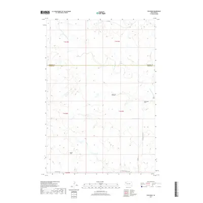
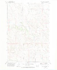
2017 Map of Fish Draw
USGS Topo · Published 2017About this map
The N Fork Moreau River meanders across the border of Harding and Butte Counties, defining a landscape of drainage draws and intermittent creeks in western South Dakota. This 2017 survey by the U.S. Geological Survey details the remote intersection of range lands where North Fork Fish Draw and Sweetwater Draw feed into the river system. The mapping reveals a sparse but established network of rural infrastructure, including Norwegian Narrow Gage Rd and Hoover-Zeona Rd, which provide access through the open terrain. Named features such as Palmer Draw and Cottonwood Cr illustrate the hydrography of the region, where water management and topographical drainage are central to the local geography. The grid of the Public Land Survey System remains the primary organizational framework for this section of the High Plains.
Find a feature on this map
20 named features on this map. Tap any name to fly to it.
Don’t see what you’re looking for? This feature index may not catch every label — zoom into the map to look around manually.
Map Details
Editions of this 2017 Fish Draw Map
This is the sole edition of this map. No revisions or reprints were ever made.
Other maps of this area

1935 · Hoover
USGS Topo · 1:125,000

1954 · Lemmon
USGS Topo · 1:250,000

1957 · Lemmon
USGS Topo · 1:250,000

1968 · Irish Butte
USGS Topo · 1:24,000

1968 · Sheep Mountain
USGS Topo · 1:24,000
1973 · Deers Ears Butte North
USGS Topo · 1:24,000
1978 · Porter Creek
USGS Topo · 1:24,000
1978 · Fish Draw
USGS Topo · 1:24,000
1978 · Tomato Can Buttes
USGS Topo · 1:24,000

1980 · Redig
USGS Topo · 1:100,000