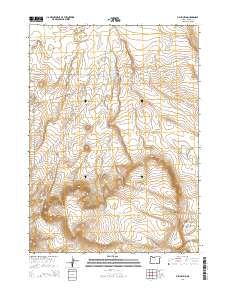
2014 Map of Fish Fin Rim
USGS Topo · Published 2014About this map
Fish Fin Rim and the massive prominence of Big Fish Fin dominate this high-desert landscape in the southeastern reaches of Oregon. The topography is defined by sharp escarpments and remote basins, characteristic of the northern Great Basin. A rare sign of early transit across this arid terrain is the Old Military Rd, which cuts diagonally through the northern sections of the township.
Find a feature on this map
18 named features on this map. Tap any name to fly to it.
Don’t see what you’re looking for? This feature index may not catch every label — zoom into the map to look around manually.
Map Details
Editions of this 2014 Fish Fin Rim Map
This is the sole edition of this map. No revisions or reprints were ever made.
Other maps of this area

1955 · Adel
USGS Topo · 1:250,000

1957 · Adel
USGS Topo · 1:250,000

1958 · Adel
USGS Topo · 1:250,000

1962 · Adel
USGS Topo · 1:250,000

1971 · Fish Fin Rim
USGS Topo · 1:24,000

1971 · Beatys Butte
USGS Topo · 1:24,000

1971 · Surveyors Lake
USGS Topo · 1:24,000

1971 · Blitzen
USGS Topo · 1:24,000

1971 · Coyote Gap SE
USGS Topo · 1:24,000

1971 · Mahogany Butte
USGS Topo · 1:24,000