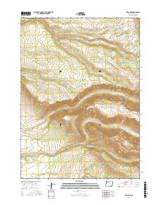
2017 Map of Fish Lake
USGS Topo · Published 2017About this map
Whorehouse Meadow and Jackman Park lie at the heart of this high-elevation landscape in Harney County, where the 2017 terrain is defined by glacial carvings and steep drainage basins. The map illustrates a network of alpine water bodies including Fish Lake, Lily Lake, and the secluded Honeymoon Lake. Water management and natural flow are central to the area's character, with the Little Blitzen River cutting through the center and Big Indian Cr draining the southern slopes. Steens Mountain Rd provides the primary access across these ridges, passing near Cold Spring Canyon. This modern survey by the U.S. Geological Survey documents the precise hydrological and topographic features of a region where high-altitude meadows and permanent lakes remain the primary landmarks, largely unchanged by dense settlement or industry.
Find a feature on this map
29 named features on this map. Tap any name to fly to it.
Don’t see what you’re looking for? This feature index may not catch every label — zoom into the map to look around manually.
Map Details
Editions of this 2017 Fish Lake Map
This is the sole edition of this map. No revisions or reprints were ever made.
Other maps of this area

1955 · Adel
USGS Topo · 1:250,000

1957 · Adel
USGS Topo · 1:250,000

1958 · Adel
USGS Topo · 1:250,000

1962 · Adel
USGS Topo · 1:250,000

1967 · Page Springs
USGS Topo · 1:24,000

1968 · Tombstone Canyon
USGS Topo · 1:24,000

1968 · Fish Lake
USGS Topo · 1:24,000

1968 · Wildhorse Lake
USGS Topo · 1:24,000

1968 · Big Pasture Creek
USGS Topo · 1:24,000

1968 · Roaring Springs SE
USGS Topo · 1:24,000