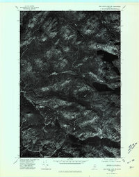
1975 Map of Fish River Lake NW
USGS Topo · Published 1981About this map
Deboullie Mountain dominates the center of this northern Maine orthophotoquad, rising above a landscape defined by deep woods and isolated water bodies. Produced from aerial imagery taken in 1975, the map reveals the intricate drainage patterns and timbered ridges of Aroostook County before modern development altered the forest structure. The high-contrast imagery highlights the stark transition from the steep slopes of the mountain down to the shores of Fish River Lake in the east. Smaller, secluded basins such as Mud Pond and the Twin Ponds appear as dark, mirror-like patches against the dense coniferous canopy. This specialized survey is particularly useful for understanding the logging access and topography of the North Maine Woods during the mid-1970s, as it captures the raw textures of the terrain without the abstraction of traditional contour lines.
Find a feature on this map
4 named features on this map. Tap any name to fly to it.
Don’t see what you’re looking for? This feature index may not catch every label — zoom into the map to look around manually.
Map Details
Editions of this 1975 Fish River Lake NW Map
This is the sole edition of this map. No revisions or reprints were ever made.
Other maps of this area

1930 · Allagash
USGS Topo · 1:48,000

1930 · St Francis
USGS Topo · 1:48,000

1931 · Fish River Lake
USGS Topo · 1:48,000

1932 · Allagash Falls
USGS Topo · 1:48,000

1933 · Allagash
USGS Topo · 1:62,500

1933 · St Francis
USGS Topo · 1:62,500

1935 · Fish River Lake
USGS Topo · 1:62,500

1935 · Allagash Falls
USGS Topo · 1:62,500

1954 · Presque Isle
USGS Topo · 1:250,000

1956 · Allagash Falls
USGS Topo · 1:50,000