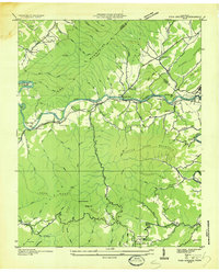
1935 Map of Fish Springs
USGS Topo · Published 1935About this map
The Watauga River corridor serves as the primary artery for settlement and industry in this 1935 survey, where the Southern Railway and State Highway No 67 follow the water's path through the Iron Mountains. Evidence of the region's industrial development is clear at Fish Springs and the nearby Lime Kiln sites, while the Power Company Transmission Line cutting across the terrain reflects the era's growing utility infrastructure. This period precedes the full impact of the Tennessee Valley Authority's local projects, showing the town of Butler and surrounding communities like Piercetown in their original valley positions.
Find a feature on this map
90 named features on this map. Tap any name to fly to it.
Don’t see what you’re looking for? This feature index may not catch every label — zoom into the map to look around manually.
Map Details
Editions of this 1935 Fish Springs Map
This is the sole edition of this map. No revisions or reprints were ever made.
Other maps of this area

1891 · Roan Mountain
USGS Topo · 1:125,000

1893 · Cranberry
USGS Topo · 1:125,000

1894 · Roan Mountain
USGS Topo · 1:125,000

1895 · Cranberry
USGS Topo · 1:125,000

1899 · Cranberry
USGS Topo · 1:125,000

1902 · Cranberry
USGS Topo · 1:125,000

1904 · Roan Mountain
USGS Topo · 1:125,000

1934 · White Rocks Mtn
USGS Topo · 1:24,000

1934 · Iron Mtn Gap
USGS Topo · 1:24,000

1934 · Elk Park
USGS Topo · 1:24,000