
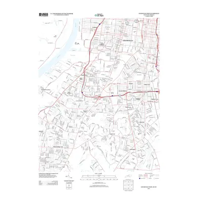
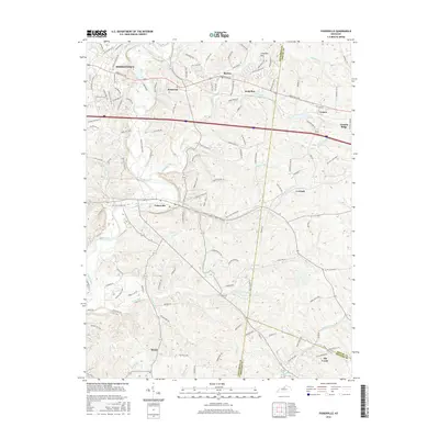
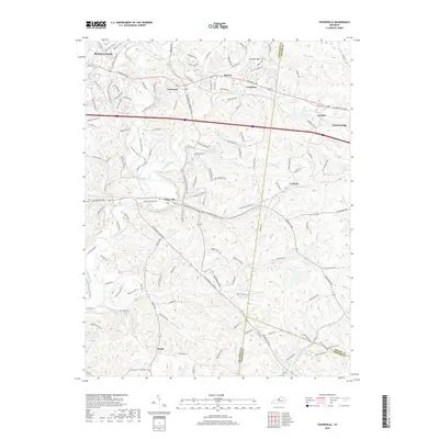
1960 Map of Fisherville
USGS Topo · Published 1961About this map
Floyds Fork meanders through the heart of this landscape, anchoring a rural territory where Jefferson, Shelby, and Spencer counties meet. The mid-century character of the region is defined by a dense network of country roads connecting small settlements like Fisherville and Eastwood. A significant cultural landmark, the Lincoln Institute at Lincoln Ridge, stands out as a prominent educational site during this era.
Find a feature on this map
29 named features on this map. Tap any name to fly to it.
Don’t see what you’re looking for? This feature index may not catch every label — zoom into the map to look around manually.
Map Details
Editions of this 1960 Fisherville Map
This is the sole edition of this map. No revisions or reprints were ever made.
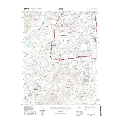
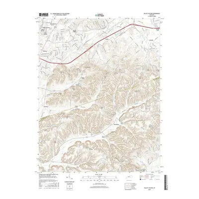
Historical Maps of Louisville Through Time
48 maps found

1909 Kosmosdale
Jefferson County, KY

1912 Kosmosdale
Jefferson County, KY

1950 Kosmosdale
Jefferson County, KY

1951 Fisherville
Jefferson County, KY

1951 Louisville East
Jefferson County, KY

1951 Valley Station
Jefferson County, KY

1953 Madison East
Jefferson County, KY

1955 Louisville East
Jefferson County, KY

1955 Louisville West
Jefferson County, KY

1955 Valley Station
Jefferson County, KY
1960 Fisherville
Jefferson County, KY

1960 Louisville East
Jefferson County, KY

1960 Louisville West
Jefferson County, KY

1960 Valley Station
Jefferson County, KY

1965 Louisville East
Jefferson County, KY

1965 Louisville West
Jefferson County, KY

1981 Kosmosdale
Jefferson County, KY

1982 Fisherville
Jefferson County, KY

1982 Louisville East
Jefferson County, KY

1982 Valley Station
Jefferson County, KY

1983 Louisville West
Jefferson County, KY

1993 Valley Station
Jefferson County, KY

1998 Louisville West
Jefferson County, KY

2010 Fisherville
Jefferson County, KY

2010 Louisville East
Jefferson County, KY

2010 Louisville West
Jefferson County, KY

2010 Valley Station
Jefferson County, KY

2011 Kosmosdale
Jefferson County, KY

2013 Fisherville
Jefferson County, KY

2013 Kosmosdale
Jefferson County, KY

2013 Louisville East
Jefferson County, KY
2013 Louisville West
Jefferson County, KY

2013 Valley Station
Jefferson County, KY
2016 Fisherville
Jefferson County, KY

2016 Kosmosdale
Jefferson County, KY

2016 Louisville East
Jefferson County, KY
2016 Louisville West
Jefferson County, KY
2016 Valley Station
Jefferson County, KY
2019 Fisherville
Jefferson County, KY
2019 Kosmosdale
Jefferson County, KY
2019 Louisville East
Jefferson County, KY

2019 Louisville West
Jefferson County, KY
2019 Valley Station
Jefferson County, KY

2022 Fisherville
Jefferson County, KY

2022 Kosmosdale
Jefferson County, KY

2022 Louisville East
Jefferson County, KY

2022 Louisville West
Jefferson County, KY

2022 Valley Station
Jefferson County, KY