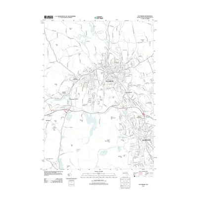
2012 Map of Fitchburg
USGS Topo · Published 2012About this map
Fitchburg and Leominster anchor this densely developed corridor in northern Worcester County, where industrial history meets a landscape of significant reservoirs and glacial hills. The Nashua River winds through the urban center of Fitchburg, passing institutional landmarks like Fitchburg State College and the large burial grounds of Saint Joseph Cem and Forest Hill Cem. To the west, the terrain rises toward Wachusett and the landmark Redemption Rock, while the southern portion of the sheet is dominated by the extensive Monoosnoc Hills and a complex system of water management including Notown Reservoir and Haynes Reservoir. The transition from the busy commercial atmosphere of Mid-City Searstown to the rural north at Marshall Farm illustrates the varied character of this regional hub in the early 21st century.
Find a feature on this map
268 named features on this map. Tap any name to fly to it.
Don’t see what you’re looking for? This feature index may not catch every label — zoom into the map to look around manually.
Map Details
Editions of this 2012 Fitchburg Map
This is the sole edition of this map. No revisions or reprints were ever made.
Other maps of this area

1885 · Worcester
USGS Topo · 1:62,500

1886 · Worcester
USGS Topo · 1:62,500

1887 · Marlboro
USGS Topo · 1:62,500

1887 · Fitchburg
USGS Topo · 1:62,500

1889 · Marlboro
USGS Topo · 1:62,500

1889 · Fitchburg
USGS Topo · 1:62,500

1892 · Worcester
USGS Topo · 1:62,500

1893 · Fitchburg
USGS Topo · 1:62,500

1893 · Groton
USGS Topo · 1:62,500

1896 · Marlboro
USGS Topo · 1:62,500